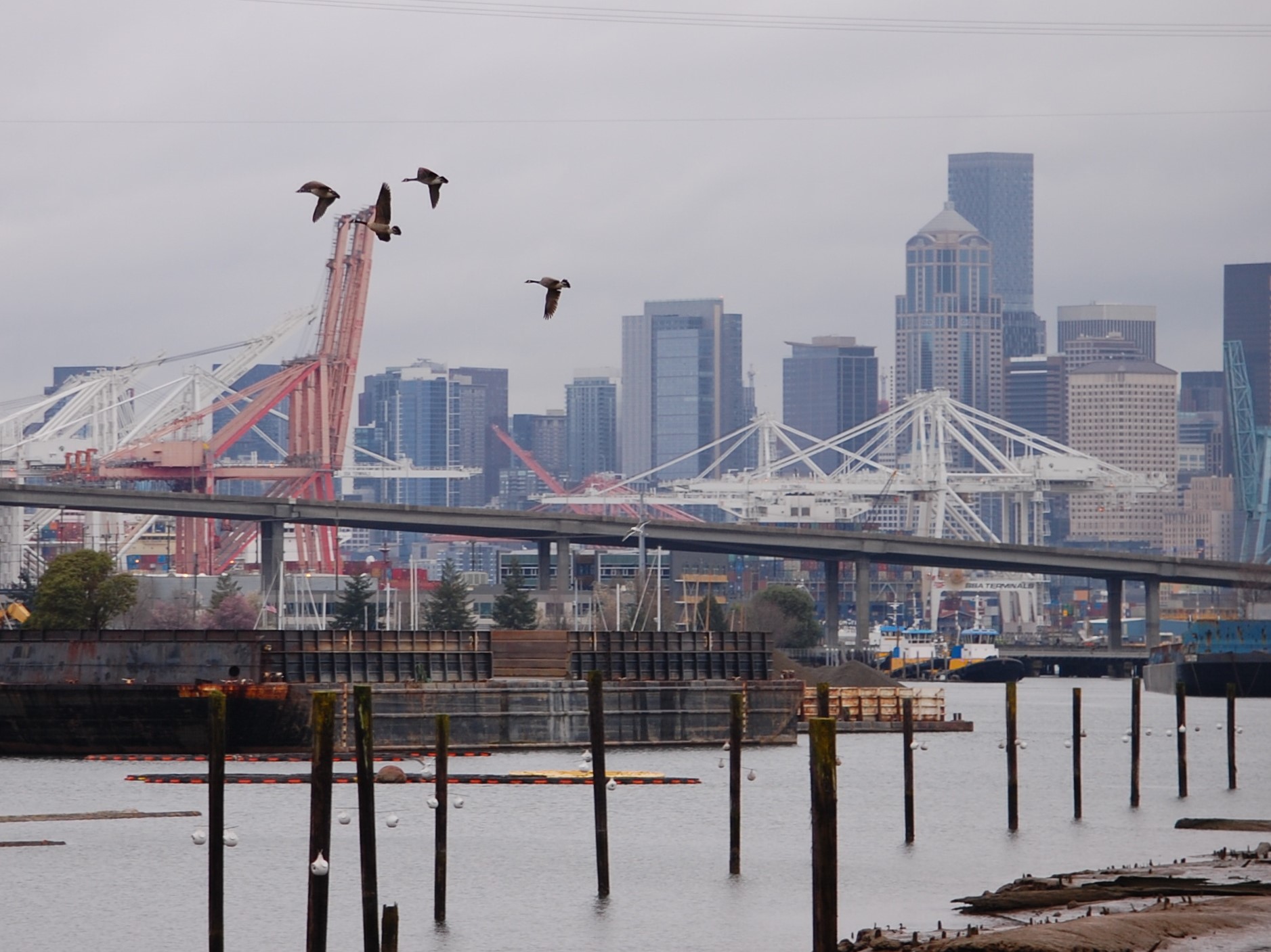
The urban Duwamish Waterway, south of downtown Seattle, is considered to be the most polluted river in the US. The Duwamish River used to be a wide, meandering river with large areas of mudflats and marshes. By the 1940s it had been channeled into the 7 mile industrial waterway we see today. Today it is a Superfund site.
Looking north, one gets a sense of the working nature of this West Coast port. From the pilings and moored barges, to the dockside gantry cranes located on the man made Harbor Island beyond the closed West Seattle Freeway is the downtown Seattle skyline.
The dredging of the Duwamish River began in 1913. The waterway was straightened and dredged as deep as 50' to allow ocean going vessels up the channel. The 20 million cubic feet of mud and sand from the Duwamish helped form Harbor Island. (Harbor Island was initially formed from some of the 58 regrades of the areas around downtown Seattle in which the tops of hills were removed. It was the largest man made island in the world from 1909 to 1938. In 1967 it regained that title following an expansion.) By the 1930s the Duwamish Waterway and surrounding area was Seattle's industrial and commercial core.
Industrial plants, including Boeing, and commercial facilities still line the waterway. Polluted by decades of industrial waste and sewage it is slowly being cleaned up. The paths to the river have numerous signs that warn against eating any of the resident fish, crab and shellfish (Dungeness Crab, mussels, clams, flounder and sole). It's hard to imagine that any warnings are necessary given the surroundings.
While the salmon that transit the Duwamish aren't considered a resident fish, the explicit warnings and the diagrams demonstrating cleaning and cooking techniques to minimize exposure to the PCBs found in salmon might give one pause to fish here.
Herring House Park and adjacent Terminal 107 Park are located on the busy arterial of West Marginal Way and have some short trails to the shoreline with nicely placed benches. However, no matter the placement there's not much that can be done with the views of oil spill booms, barges, cranes, tower silos, warehouses and tugboats.
The Duwamish has seen a lot of changes in the last 120 years. It was once fed by three rivers - the Green, White and Black rivers. A flood by the White River in 1906 changed that river's course so that it empties into the Puyallup River. The Black River flowed from Lake Washington but dried up with the opening of the Ship Canal in 1916 which lowered Lake Washington nine feet. Now it is just the Green River that feeds the Duwamish. Reference as the Duwamish begins just 7 miles upstream from where the waterway empties into Elliott Bay. Before that it is the Green River.
The Duwamish Cultural Center is located across West Marginal Way from Herring House and Terminal 107 parks. One of the Duwamish tribe's largest villages was burned down by settlers in 1895 on the land in which those parks now stand.
The Duwamish people are the indigenous tribe that lived in what is now the greater Seattle area - Seattle's first people. The city is named after the Duwamish Chief Sealth. They were one of the first area tribes to sign the 1855 Treaty of Point Elliott. In return for $150,000 they were to receive land for a reservation as well as hunting and fishing rights.
The 600 members are still awaiting the land and fishing rights. In fact the tribe has never been recognized by the Department of the Interior. Without the recognition there is no funding for housing, education or health care.
The skeleton of the boat is a 5/8 scale replica of a North Pacific halibut schooler built using traditional methods by boat building students at Tacoma's Bates Technical College . Almost 150 fishing similar boats were built at Seattle area boatyards from 1911-1929. As of 2002, fourteen of these vessels were still operating in Alaska!